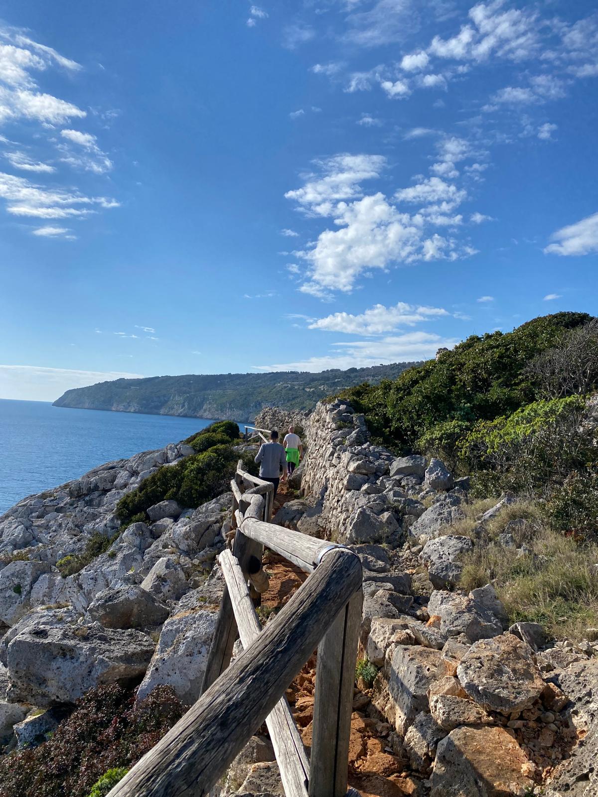
Hiking in Salento is one of the best ways to discover the natural beauty of Capo di Leuca, the southernmost part of Puglia. Here, scenic coastal trails, Mediterranean vegetation, dramatic cliffs, ancient paths and dry-stone walls connect the countryside to the sea.
Many of these routes were not originally created for tourism. They were once used by farmers, fishermen and traders to reach the coast, transport goods and travel between small rural settlements.
Alongside these historic paths are ancient pilgrimage routes that still lead towards Santa Maria di Leuca and the Sanctuary of Santa Maria de Finibus Terrae.
From the Cipolliane Trail to the Ciolo Gorge, from the Salt Trails to the southern Via Francigena, hiking in Capo di Leuca means exploring not only its landscapes but also centuries of local history.
The Cipolliane Trail: Following Ancient Rural Paths
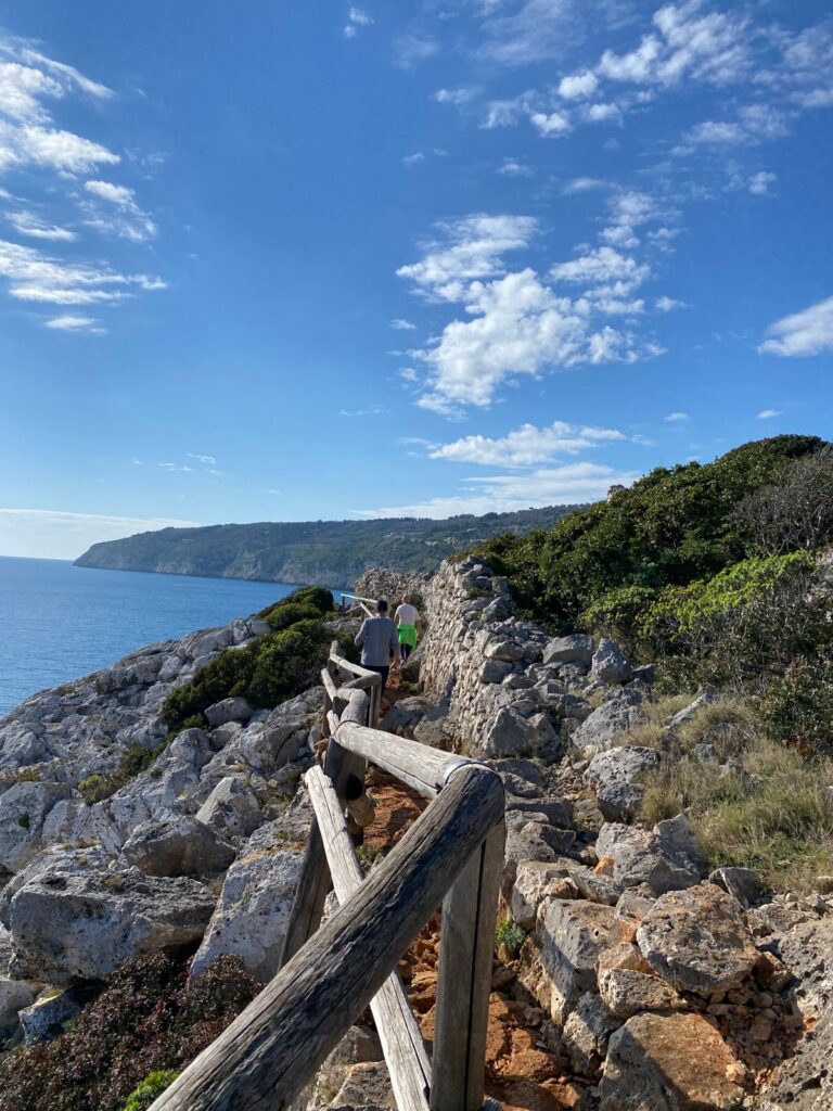
Among the best-known hiking trails in Capo di Leuca is the Sentiero delle Cipolliane, located in the municipality of Gagliano del Capo.
The route stretches for approximately 2.5 kilometres between the Ciolo area and Porto Vecchio di Novaglie.
According to the Municipality of Gagliano del Capo, the walk takes approximately one hour, involves negligible elevation change and is classified as a tourist-level trail (T).
Access is free, although the route is not suitable for people with mobility difficulties.
But perhaps the most fascinating aspect of the Cipolliane Trail is its history.
This ancient rural path was once used by farmers, fishermen and traders. Donkeys and other pack animals helped transport salt and other goods from the coast towards inland villages.
Today, walking among dry-stone walls and Mediterranean vegetation means following one of the historic routes that connected the sea with the Salento countryside.
The Cipolliane Caves: Traces of Prehistoric Life
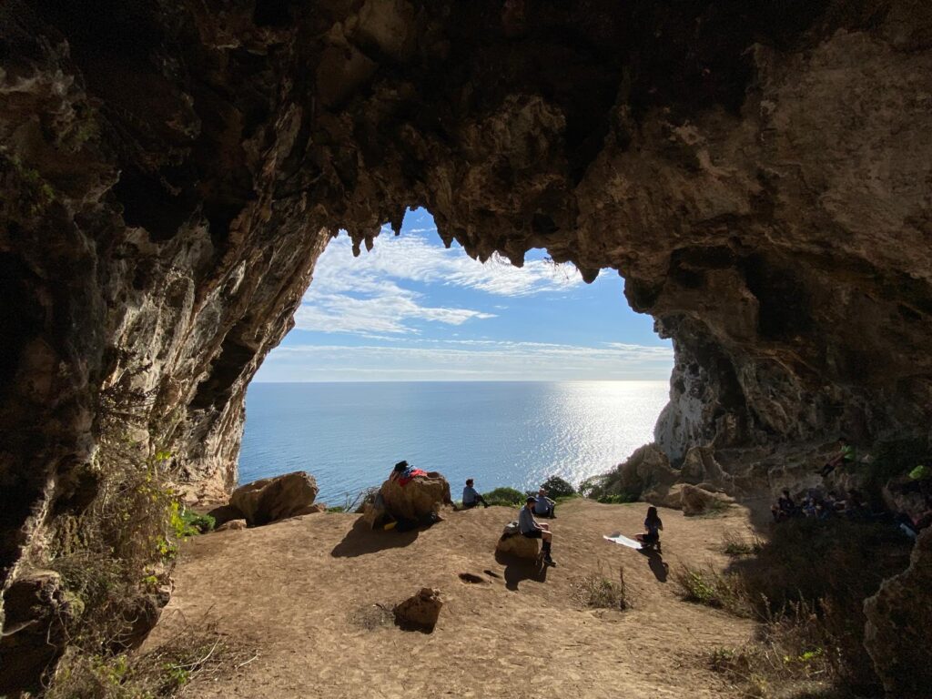
Narrow paths branching off the main trail lead towards the Grotte Cipolliane, three natural caves formed in the limestone cliffs.
The history of this area, however, began long before the rural paths and agricultural activities.
Numerous fossils and fragments of marine shells have been found in the surrounding area, providing evidence of the geological transformations that shaped the landscape.
Traces of prehistoric human presence have also been discovered inside the caves, including pebbles bearing unusual engravings whose meaning remains uncertain.
In just a few kilometres, this trail offers a journey through different periods of history: from geological formations and prehistoric settlements to the traditional rural life of Salento.
The Ciolo Trail: From the Countryside to the Sea
Not far away lies another of the area’s most famous walking routes: the Sentiero del Ciolo.
The trail begins in the countryside near Gagliano del Capo and descends towards the spectacular Ciolo inlet.
Along the way, hikers encounter rocky slopes, natural caves, dry-stone walls and Mediterranean vegetation.
The route described by the municipality is approximately 4 kilometres long, takes around one hour and is classified as a tourist-level trail (T), although it is not recommended for people with mobility difficulties.
As the path approaches the coastline, the landscape gradually changes until it reaches the deep Ciolo Gorge, enclosed between towering limestone cliffs.
More Than One of Salento’s Most Photographed Views
The Ciolo is particularly famous for its bridge and the small inlet below it.
However, exploring the area on foot reveals a much more complex natural environment.
Along the trail, visitors can discover rocky cavities and evidence of ancient human activity.
The vegetation is also of particular natural interest, with plant species typical of the rocky coastline of Capo di Leuca.
The Ciolo is therefore much more than a scenic viewpoint: it is a gateway to the natural and rural landscape of southern Salento.
The Salt Trails: Ancient Routes Between the Countryside and the Coast
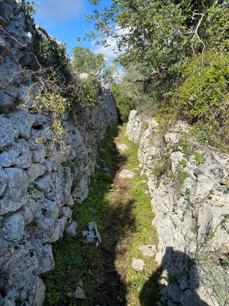
Moving towards Marina di Corsano, visitors encounter a network of historic paths known as the Vie del Sale, or Salt Trails.
These are not a single hiking route but a series of ancient paths connecting inland settlements with the coastline.
Their name reveals their original purpose.
Along this stretch of coast, salt was traditionally collected from natural rock pools after seawater had evaporated.
The paths allowed local communities to reach the sea and transport this valuable resource back inland.
Today, these historic routes cross a landscape of limestone cliffs, Mediterranean scrub and dry-stone walls, some of which extend almost to the water’s edge.
They are a striking example of how the natural landscape and human activity have shaped one another throughout the history of Capo di Leuca.
From Marina Serra to Torre Nasparo: A Longer Coastal Hike
For experienced walkers looking for a more challenging excursion, the Costa Otranto–Santa Maria di Leuca and Bosco di Tricase Regional Natural Park offers a route connecting several historic trails.
The itinerary begins near Torre Palane, in Marina Serra, and initially follows the coastline past natural swimming pools and sea caves.
From here, it joins the Sentiero del Nemico, an ancient path climbing the coastal ridge towards Torre Nasparo.
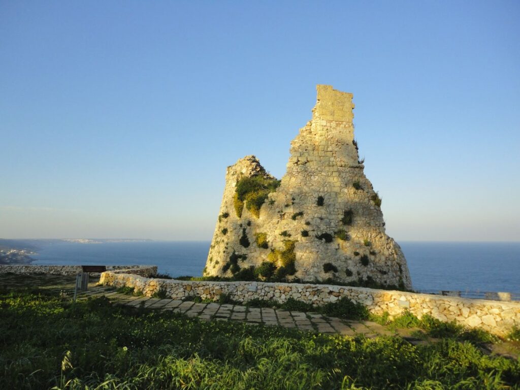
Torre Nasparo is a historic coastal watchtower overlooking the Strait of Otranto.
According to local tradition, the name Sentiero del Nemico, meaning “Enemy’s Trail”, refers to the narrow and steep nature of the route, which may once have helped local inhabitants defend themselves against raiders arriving from the sea.
From Torre Nasparo, the route descends towards the coastline again and continues in the direction of Marina di Corsano, where it connects with the Salt Trails.
A Route for Experienced Hikers
This is considerably more demanding than a short coastal walk.
According to the Regional Natural Park, the complete itinerary covers approximately 13.1 kilometres, takes around 6 hours and 38 minutes, and involves 478 metres of total ascent.
It is classified as an E-level hiking route, intended for walkers with suitable experience and equipment.
Particular care is required along the Sentiero Grotta del Soffio.
Rough seas can move large rocks and make sections of the original path difficult to identify. The park therefore recommends following the GPS track carefully.
This is an important reminder that coastal trails are natural environments and their conditions can change.
Before attempting longer hikes, always check the route’s current condition, the weather forecast and any updated guidance from the relevant local authorities.
The Southern Via Francigena: Walking to Santa Maria di Leuca
The trails of Capo di Leuca tell more than the story of local communities and their relationship with the land.
Walking here also has another meaning: pilgrimage.
Santa Maria di Leuca marks the southern destination of the Via Francigena del Sud, the southern extension of one of Europe’s historic pilgrimage routes.
Official Via Francigena signage identifies Capo Santa Maria di Leuca as the destination of the route continuing south from Rome.
For those crossing Salento on foot, reaching Leuca means arriving at a place that has represented both a geographical and symbolic frontier for centuries.
Here, at the southern tip of the Salento peninsula, the land opens towards the Mediterranean and the historic routes leading eastwards.
Finibus Terrae: Where the Journey Ends
The symbolic destination is the Sanctuary of Santa Maria de Finibus Terrae, located on the Punta Meliso headland.
The Latin expression Finibus Terrae means “at the ends of the earth”, a name that becomes particularly meaningful for travellers arriving after days of walking.
Standing in front of the sanctuary, the land seems to come to an end, giving way to the sea.
The tradition of pilgrimage to Leuca is centuries old and continues today through several routes crossing Salento.
One of these is the Via Leucadense, which begins in Brindisi and reaches Santa Maria di Leuca after approximately 128 kilometres.
The complete itinerary is divided into seven days of walking.
Along the way, pilgrims encounter historic chapels, crypts and places of religious devotion before reaching Finibus Terrae.
The final section also passes near Leuca Piccola, in Barbarano del Capo, an ancient stopping place that once welcomed pilgrims travelling towards the sanctuary.
But that is a story worth exploring in its own right.
Making the Via Francigena More Accessible
Efforts to develop walking routes in Salento are not limited to preserving the past.
In August 2026, the Italian Ministry of Tourism announced that the project “Per una Via Francigena del Sud accessibile a tutti” — aimed at making the southern Via Francigena accessible to everyone — was approaching completion.
The project focuses on approximately 120 kilometres between Lecce and Santa Maria di Leuca, divided into five stages.
Its objectives include identifying critical points along the route, mapping trails and services, carrying out maintenance work and introducing tools to improve accessibility for visitors with different needs.
Rest areas, digital resources and other accessibility measures are also planned.
This initiative highlights the growing importance of walking tourism in Salento.
Beyond its famous beaches and summer destinations, the region offers historic paths, traditional villages, natural landscapes and rural heritage.
It is a form of slow tourism particularly well suited to spring and autumn.
When Is the Best Time to Hike in Capo di Leuca?
Spring and autumn are generally the most pleasant seasons for hiking in Capo di Leuca.
Milder temperatures make walking more comfortable and allow visitors to experience a landscape very different from the one seen during the busy summer months.
In spring, Mediterranean vegetation becomes particularly colourful and lively.
In autumn, cooler temperatures make walks along the coast and through the countryside especially enjoyable.
Winter can also offer beautiful days for hiking, although coastal routes require additional attention to weather conditions, strong winds and rough seas.
During summer, it is advisable to avoid walking during the hottest hours of the day, as many trails are exposed to direct sunlight and offer little shade.
Always carry sufficient water, wear suitable footwear for rocky terrain, use sun protection and check your route before setting out.
For more demanding hikes, distance alone should never determine the difficulty of a trail. Terrain, elevation changes, exposure and coastal conditions can all affect the experience.
Discovering a Different Side of Salento on Foot
Walking these trails reveals a side of Salento that is easy to miss when travelling by car.
Dry-stone walls become more than features of the landscape: they mark the boundaries of ancient rural paths.
Coastal watchtowers recall a time when the sea could also represent danger.
The Salt Trails tell the story of trade and everyday work in local communities.
The caves take visitors back to prehistoric times.
And the great pilgrimage routes transform Santa Maria di Leuca into the final destination of a much longer journey.
From the Cipolliane Trail to the southern Via Francigena, the common thread is the same: discovering the territory one step at a time.
Explore the Trails of Capo di Leuca from Torre Vado
For guests staying at Pajara alle Macchie, the hiking trails of Capo di Leuca offer an opportunity to explore the southernmost part of Salento beyond its beaches.
From the countryside around Torre Vado, visitors can combine coastal hikes with visits to historic villages, walks through rural landscapes and time spent discovering local traditions.
After a day exploring ancient paths, dry-stone walls and dramatic coastal scenery, returning to a traditional pajara feels like a continuation of the same story.
It is the story of a landscape shaped by stone, generations of human activity and the enduring relationship between countryside and coast.
A different way to experience Salento, especially outside the summer season, when the region can be explored at a slower pace.
Pajara alle Macchie. Nature, tradition, emotion.
Photo Credits
Torre Nasparo: photograph by Lupiae / Wikimedia Commons – CC BY-SA 3.0. Image resized and optimised for web use.
Leave a Reply